|
|
Information Society > Egypt's Poverty Map
Information Society
|
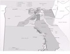
Led the vision and implementation of the first GIS Poverty Map in the World. The map defines poverty in Egypt. In every governorate, city and village poverty, extreme poverty and per capita economic and social indicators are defined and dynamically updated (annually). The data (content) sources are from more than 1500 centers across Egypt that were built in less than a decade from 1985-1995. A book " The Description of Egypt.... an Information Perspective" was published for the first time in 1995. |
|
